Tuesday, January 28, 2014

Mount Doom and the Tama Lakes Tramp

January 29, 2014

It is known locally as Mount Ngauruhoe, but was made famous in The Lord of The Rings movies posing as Mount Doom.  It was chosen because of its bare volcanic sides and symmetrical cone.  It is 2,291 Meters and is snow covered in the winter.  Ngauruhoe and its close neighbor Tongariro are popular ski resorts in the winter and just as popular in the summer for tramping.
 
Mount Ngauruhoe - also known as Mount Doom
Our tramp today took us to the alpine lakes Upper Tama and Lower Tama.  The trip was 17 kilometers return and took us 5½ hours.  We started in Whakapapa, parked Lucky at the trail head, packed a lunch and off we went.   The track starts with a slowly winding path through what they call tussock country and alpine herb fields.  

Mount Tongariro in the background.  

We had a beautiful sunny day so slowly the sweaters came off as we walked up and down over the hills.   By the time we reached the Lower Tama Lake the wind had come up and we started putting clothes back on. 
 
Lower Lake Tama

Upper Lake Tama

Lower Tama Lake, sitting at 1240 meters is startlingly beautiful with bright turquoise water.  These lakes were created when a fiery volcanic explosion took place blowing a hole in the rock.  The craters have since filled with water and the color is created by the minerals that have washed into it.  To see the Upper Tama Lake you have to climb to the viewpoint at 1440 meters.  It was quite a windy day with gusts up to 50 km per hour.  As we walked along the ridge, you felt like you could be blown away.   

We did the return trip via the loop to see the Taranaki waterfalls.  I think this is the fourth or fifth waterfall viewing we have done so far on this trip.  They are all pretty much the same, but all very different. 
Taranaki Falls
Then it was back to Lucky and off to a campsite for dinner and another cozy evening.  In the morning we started planning the days’ adventures.  We plan to take the ferry to the South Island on February 4th so we still have some days to meander our way down to Wellington.
Guidebooks and maps to plan the day!


The Forgotten World Highway

January 27, 2014

There are four major volcanoes on the North Island and as I said in my last post, there are legends to tell.  The one we just visited – Mt Taranaki, was said to have originally stood together with the other three; Ruapehu, Tongariro and Ngauruhoe in the middle of the island.  Maori legend tells the tale of a love affair between Taranaki, the youngest of the four volcanoes and Pihanga, a beautiful mountain on Lake Taupo.  But Pihanga was Tongariro’s lover and after losing a fiery battle, Taranaki fled in shame scraping out a valley in his wake and leaving a river of tears now known as the Whanganui. 

Having seen Mt Taranaki, we decided to visit his cousins a little further North.  We prefer to take routes a little off the beaten track and the lure of “The Forgotten World Highway” was irresistible so we fueled up and set off to see the sites.  Well, we now know why it was forgotten.  It leads through an area of rugged land passing through the Tangarakau Gorge and over four natural saddles.  So rugged and isolated in fact, that many farmers gave up their attempts to build a homestead years ago.  The slopes are steep and the amount of straight roadway is incredibly scarce. 

Passing through a tunnel that was dug out by hand.  It collapsed at one point and is now reinforced with concrete walls.
As we twisted and turned on the 155-kilometer highway, we decided to make our trip a little more challenging and took a side trip to the “Bridge to Somewhere”.  With a name like that, you just have to go and see what it’s all about.  After driving an hour and a half on a windy dirt road, we came upon the bridge.  It lived up to it’s name and was most certainly a bridge to somewhere – but nowhere we could go as the road just beyond the bridge carried warnings of near certain death from falling rocks, steep ravines, and washed out roads and advised not be undertaken unless you were traveling in a 4x4 or possibly a tank.  We didn’t think Lucky was up to it, so we turned back and rejoined the Forgotten World Highway. 

The Bridge to Somewhere
We soon reached another unusual place – the town of Whangamomona.  What’s unusual about this place is that they decided to declare themselves an independent republic in 1988. You can buy a passport from the local hotel or the border crossing, if you can find it.  We arrived at the same time as a bike rally and had to share the town with about 140 motorcycle enthusiasts.  The republic of Whangamomona is said to have a grand total of 30 residents.  With all the visitors that day, we outnumbered them 5 to 1 and could probably have overtaken the country, so to speak.  The town itself looked a little “forgotten”, well in keeping with the highway that runs through it.  To be totally fair with the residents of Whangamomona, they have been active in protecting their community and posted a highway sign advising us to “keep our eyes open while driving”.  Very good and sound advice indeed.  Makes you wonder why no other community has thought to post such a sign.


A little further along the highway we spotted a deer following behind a horse on the side of the road. The deer almost looked like an albino he was so pale; but so beautiful.  This was the third strange sight we had seen that day, the first being a goat head on the side of the road, and the second a cow that looked like it had been slaughtered, also on the side of the road.  Rather gruesome I must say. 
 
Strange sight of the day ... a beautiful deer following a horse.

We arrived in Taumarunui in time to set up camp for the night and just ahead of a rainstorm.  We cooked a little dinner and snuggled in for movie night.  Thanks to Fredrik for the fine selection of entertainment we have available and thanks to the guys at the Apple store for fixing my computer so we can finally watch them. 

Saturday, January 25, 2014

No Trekking Allowed!

January 25, 2014
Another black sand beach looking out to the Tasman Sea
 
A 100 year old tunnel dug into the cliff side.  They used to bring the cattle down the coast and through the tunnel.
Absolutely no trekking and definitely no hiking allowed.  In this country, it’s all about tramping.  So I guess you could call us a couple of tramps now. 

Which I suppose is quite suiting since we are living in a van, which I guess is one step away from living in a cardboard box.  It has been a slippery slope for us – having gone from living in an apartment in Istanbul and one in Tehran to living on a 44-foot sailing yacht to now living in a minivan.  I used to say we were within arms reach on the boat but now in the van, well it’s just that much cozier. 

We are quickly getting used to the Kiwi lingo where a sweater is called a jersey, an SUV is called a ‘ute’ and a cooler is called a chilly bin or an eski.  And we either go for a walk or if it’s more than 2 hours it qualifies as a tramp. 

Taranaki & Whanganui

The last couple of days, we have been making our way South, heading towards New Plymouth.  You would almost think we were in Great Britain with these names.  Or Ontario even, as we have come across towns called Raglan, Stratford, Hamilton and Dunedin.  The British have certainly left their prints here, but the Maori are slowly changing things back to their original names.  We have made it to Maunga Taranaki, or as the British called it Mount Egmont.  Taranaki sounds so much more impressive though, and this mountain comes with its own legend. 

Anyhow, along the coast we stopped at another beautiful black sand beach, took a hike out to the “Three Sisters” which are now two because one collapsed but it looks like a third is forming again, hiked along the Whitecliff Walkway and stopped in at Mike’s Brewery to test a little organic beer.  We bought a coffee flavoured beer (still to be tested) and tried some of their pale ales.  All very tasty and tempting to sit and sip a few more. 
The Three Sisters

View from the Whitecliffe Walk

Curious sheep

The local brew house and it's latest production.
We arrived to Taranaki and prepared for our first big hike of the season.  Sorry, I mean tramp!  It’s a good thing we brought along some decent hiking shoes this time.  Our hikes in South America were done in running shoes and trekking sandals.  Not ideal for those long tramps. 


We started with the Enchanted Track which met up with a couple of other tracks; passed through what is called the goblin forest, some beautiful ancient lower alpine forests; stopped at some spectacular view points; crossed many small wooden bridges and a long swing bridge; not to mention the thousands (okay, maybe hundreds) of steps up and down for a total tramp of about 3 ½ hours.  We arrived back to the car a little tired but feeling quite pleased with ourselves for having managed such a long hike in less time than the signposts indicated it would.  Not so bad for a couple of tramps!
Mount Taranaki - 2518 meters


We climbed up as high as 1141 meters.

These Sailors are Kiwi Bound

January 23, 2014
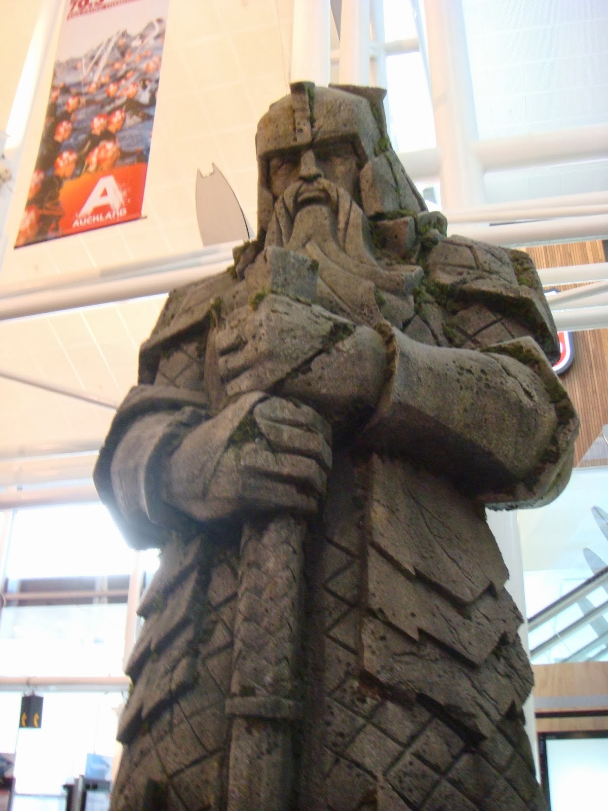
Auckland Airport - a LOTR Welcome

Here we are ...  New Zealand at last.  This has been a dreamed about destination for both of us for many years.  It was an early departure from Brisbane on Tuesday morning and a short flight over the Tasman Sea on Virgin Airlines.  This was the first time we had flown with Virgin.  It was quite ok even though we had to pay for our food and the sandwiches were a bit soggy and the coffee rather weak.  But we arrived on time and the clearing-in process was a piece of cake.  We bought a SIM card for our phone (our first priority), and then called our rental company to pick us up at the airport.  
Lucky, our new home on wheels

We rented a Lucky Chaser camper van, which will be our home for the next 9 ½ weeks.  Our little van comes complete with a toilet/shower, two-burner stove and a mini fridge, bench seating and a table that drops down to make a double bed.  New Zealand is very camper / trailer friendly and we expect to find it easy to find a place to stop and sleep for the night as we make our way around the North and South islands. 

Excited as we were about our home on wheels, we didn’t actually move into it properly until today.  We spent our first two days in New Zealand visiting with Lance and Triana and enjoyed their wonderful hospitality.  Lance took us around and showed us the Vernall homestead.  He has about 400 head of beef on his property, which seems to stretch out as far as the eye can see.  His family live nearby and his brothers operate a dairy farm.  From our short time here, we noticed there are two kinds of farmers; either cattle or sheep.  And you find plenty of each, as the hillsides are dotted with animals peacefully grazing on the lush grasses. 
Nice views in Pirongia

Jens and Lance
New Zealand doesn’t have any endemic mammals.   The first mammal to arrive was the pig, apparently dropped off by the famous explorer, Captain Cook.  And the pig was followed by deer, horses, cows and sheep as well as your chickens, rabbits and assorted small animals.  They all live quite peacefully here since there are no natural predators.   In fact, New Zealand doesn’t have any dangerous animals whatsoever, contrary to its closest neighbor Australia, which seems to host many of the world’s most venomous creatures. 

Waikato and The King Country

We had landed in Auckland and made our way down past Hamilton to where Lance and Triana are living.  This area is known as Waikato and The King Country.  It is famous for it’s caves, beaches and small towns. 

Our first day of exploring took us to the Bridal Veil Falls or Waireinga as it is known locally.  A short walk takes you to the beautiful falls.  The site was well marked and with good walking paths and viewing locations.  If all of New Zealand is as organized as this, we’ll have no problems at all getting around.  From there we made our way through the country side to the coast stopping at the black sand beaches and view points along the way.  The Te Toto Gorge was a temptation for us but we didn’t have time to do the 4-hour hike that day.  I guess we’ll just have to pass by some things.  We had a nice lunch in Raglan, which is a very picturesque town on the coast, before heading home.

Bridal Veil Falls

Black Sand Beach
Today we set off around mid-morning with the Waitomo Glowworm caves as our destination.  There are more than 300 mapped caves in the area and the famous Glowworm cave has been open to tourists for more than 100 years.  There is a river running through the caves and it was the fourth generation of the owners who was our tour guide.  The 45-minute tour ended in a boat ride in the dark with only the light of the glowworms clinging to the ceiling to light the way.  What a fantastic place to visit. 
Exit at the Glowworm caves (no pictures allowed inside as that would disturb the worms)

Bushwalk in Waitomo


From the Waitomo cave site we embarked on what we thought would be a 2.5 km bush walk.  It ended up being about 6 km because we didn’t realize it wasn’t a loop, but a one-way trip.  So we of course had to hike back to the car park where we had left Lucky. 

We continued on our journey after a little lunch in the van.  Next stops were the Mangapohue Natural Bridge and the Piripiri caves and we finished our touring day at the Marokopa Falls.  Thankfully, all of these were a short walk from the car park.


So ends our first couple of touring days and our first night in our motorhome.